The Role of Satellites in Protecting Europe’s Critical Energy Infrastructure
Europe's energy infrastructure faces growing threats from physical sabotage to cyber interference. Incidents such as the Nord Stream explosion and damage to the Estlink 2 undersea power cable have exposed these vulnerabilities, highlighting the increasing importance of security services. Norway is leading the way in leveraging these satellite-based technologies to enhance the monitoring of offshore energy infrastructure.
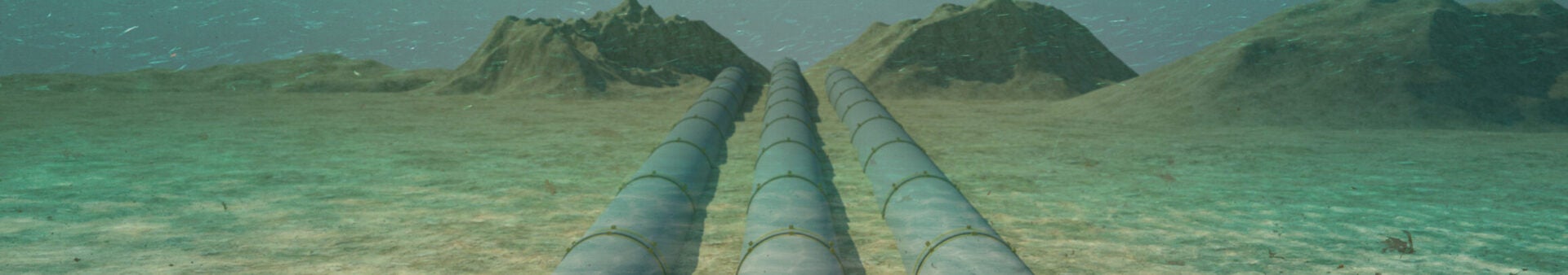
Over the past few years, there has been an increase in physical attacks on critical energy infrastructure across Europe. Incidents such as the 2022 Nord Stream explosion, 2023 Balticonnector pipeline damage, and 2024 Estlink 2 cable cut display the growing vulnerability of offshore energy networks. Ensuring the resilience of European energy infrastructure against natural disasters and sabotage is crucial, and advanced monitoring technologies need to play a vital role in detecting, attributing, deterring, and quickly responding to these threats.
Norway, a critical energy player for Europe, is particularly vulnerable due to its extensive coastlines, which host offshore energy facilities and marine transportation routes. The North Sea and Arctic Ocean contain over 9,000 km of pipelines, which are a vital link connecting Europe to Norwegian energy production. Norway is also a leader in European space exploration and remote sensing, which is crucial for monitoring offshore infrastructure.
Kongsberg Satellite Services (KSAT) has the most extensive ground station network, with over 200 antennas across 25 locations. Their Svalbard and Antarctica ground stations allow for fast downlinking from polar-orbiting satellites. As Martin Skedsmo, Key Account Manager at KSAT explains: “KSAT has a major time advantage with the global antenna coverage.” These capabilities are particularly useful for monitoring offshore infrastructure, where real time data is crucial for fast response to threats. KSAT’s Oil Spill Detection and Vessel Detection services combine Synthetic Aperture Radar (SAR) and optical data to identify vessels even when ships’ Automatic Identification System (AIS) is spoofed or deactivated. This is useful for detecting shadow fleets, mysterious maritime activity, or potential sabotage attempts of underwater infrastructure.
Space Norway, Northern Europe’s leading satellite operator, is enhancing its surveillance and navigation services. Their MicroSAR satellites, combining SAR, AIS and optical imaging capabilities into a single satellite, will enhance maritime surveillance. Additionally, they are involved in the launch of KONGSBERG’s N3X consolation, a set of three polar orbiting satellites equipped with AIS and radio frequency capabilities aimed to “provide satellite maritime surveillance data to cover Norwegian Areas of Interest.” These advanced monitoring technologies are crucial for Norway to protect its energy infrastructure from adverse actors.
In a conversation with Marianne Moen, Head of Communication at the Norwegian Space Agency she emphasizes how, “it is critical to ensure satellite systems are resilient and cyber-secure,” especially given the growing importance to national security. This is underscored by the “suspected undersea sabotage” of the Svalbard cable in 2022. Space Norway is currently upgrading the Svalbard undersea cable system to enhance its capacity and ensure continued reliable communication. Major General Odd-Harald Hage, Business Developer at Space Norway further stressed the critical nature of these subsea communication cables, stating, “if the wrong cables are damaged, the entire financial system could collapse.”
In addition to physical threats to infrastructure, interference with satellite signals, such as GPS jamming and spoofing, is becoming a more prevalent threat for maritime, communication, and aerospace operations. Major General Hage emphasized the severity of these incidents, noting that “Norwegian authorities have raised formal complaints to Russian authorities about GPS jamming and interference.” To address these evolving threats, Norway hosts an annual Jammertest event in Andøya, bringing together industry experts, users, and authorities to collaborate in responses to jamming and spoofing. In September 2024, during one of the exercises at Andøya, a cable connected to a jammer was deliberately cut. The jammer was installed by the Norwegian Defence Research Establishment (FFI) to test navigation systems under electronic warfare. This incident shows the seriousness of these escalating threats to critical infrastructure.
The attribution of sabotage incidents remains a large challenge. As Major General Hage said, “attribution is a political act – and under the right conditions could be perceived as a declaration of war,” demonstrating the importance of fast identification of interference incidents to ensure accurate attribution of these acts. NATO Article 5 highlights the stakes of attributions, misidentification or issues in finding who is responsible could impact and prevent collective defense responses.
Remote sensing technologies can also be leveraged for offshore energy infrastructure planning. Malin Johansson, Group leader Earth Observation at The Arctic University of Norway (UiT) explained, “satellite data can be used to analyze sea ice location and drift to give advice on safe and suitable locations for offshore wind farms.” Having accurate data on wind patterns, sea ice drift and other factors is critical for the protection and safety of offshore wind farms, pipelines, and marine ship routes in the Arctic. For onshore energy infrastructure monitoring, Interferometric Synthetic Aperture Radar (InSAR) can show changes in displacement allowing early identification of damage to infrastructure such as leaks in oil or gas pipelines and allowing for efficient and proactive maintenance and risk mitigation, reducing the likelihood of severe damage to infrastructure.
As energy infrastructure becomes increasingly interconnected and critical to our societies, Europe’s energy security depends on the proactive monitoring and safeguarding of these vital systems. Policymakers need to prioritize and support the integration of various remote sensing systems for the monitoring of energy infrastructure. The challenge lies in integrating multiple detection systems—radar, AIS, hyperspectral imaging—while minimizing the risk of interference or manipulation. Cross-sector collaborations and data-sharing frameworks are essential so both academia and private sectors can leverage space-based imagery, fostering a coordinated, international approach to the monitoring and protection of critical energy infrastructure.

Amelia Pilot
Undergraduate Seminar FellowAmelia Pilot is a fourth-year student from London in the Vagelos Integrated Program in Energy Research (VIPER) studying physics and material science and engineering. Pilot is also a 2025 Undergraduate Student Fellow.